
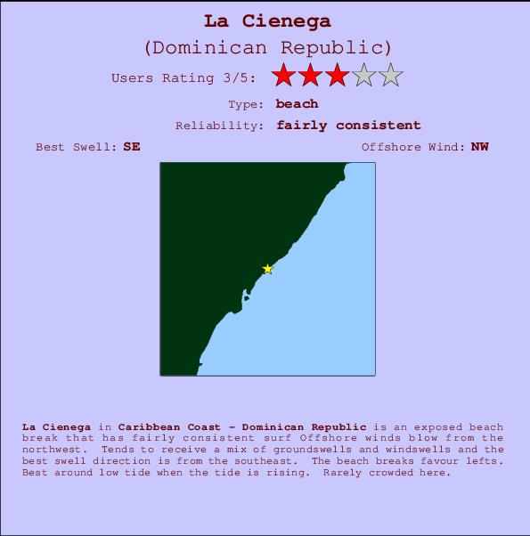
La Cienega Surf Guide
La Cienega on the South Coast is an exposed beach break that has quite reliable surf The best wind direction is from the northwest. Tends to receive a mix of groundswells and windswells and the best swell direction is from the southeast. Waves at the beach tend to peel to the left. Best around low tide when the tide is rising. Rarely crowded here.
La Cienega Spot Info
| Type: | Rating: | Reliability: | Todays Sea Temp*: |
|---|---|---|---|
| fairly consistent | 28.5°C*ocean temperature recorded from satellite |
Surfing La Cienega:
The best conditions reported for surf at La Cienega occur when a Southeast swell combines with an offshore wind direction from the Northwest.

Voorspelde Golfenergie (Kracht): 12 uur


La Cienega Surf:
Thursday, 16 July 2026, 05:30 Local time| Thursday 16 | ||||
| 5AM | 8AM | 11AM | 2PM | |
| Wave (m) | ||||
| Periode (s) | 7 | 7 | 7 | 6 |
| Wind (km/h) | ||||
| Wind | cross | cross- on |
cross- on |
cross- on |
- /breaks/La-Cienega/forecasts/latest
La Cienega Surf Guide
La Cienega on the South Coast is an exposed beach break that has quite reliable surf The best wind direction is from the northwest. Tends to receive a mix of groundswells and windswells and the best swell direction is from the southeast. Waves at the beach tend to peel to the left. Best around low tide when the tide is rising. Rarely crowded here.
La Cienega Spot Info
Type: Rating: Reliability: Todays Sea Temp*:  Beach
Beach 3
3fairly consistent 28.5°C*ocean temperature recorded from satelliteSurfing La Cienega:
The best conditions reported for surf at La Cienega occur when a Southeast swell combines with an offshore wind direction from the Northwest.
Voorspelde Golfenergie (Kracht): 12 uur
Gebruik de tabbladen hierboven om de zeewatertemperatuur bij La Cienega te bekijken, foto's van La Cienega, La Cienega gedetailleerde golfvoorspellingen, wind- en weersvoorspellingen, La Cienega webcams, actuele wind in Caribbean Coast live weerstations en La Cienega getijdenvoorspellingen. De link van Dominican Republic golfkaarten opent een grote afbeelding van Dominican Republic en de omliggende zeeën. Deze golfkaarten kunnen worden dynamisch gemaakt worden met de verschillende golfcomponenten, golfenergie, golfperiode, golfhoogte, samen met de wind en weersvoorspellingen, het actuele weer en de zeetoestand volgens golfboeien uit Dominican Republic, langskomende schepen en weerstations op de kust. Elk voorspelling pagina's voor dit surfstrand zijn voorzien van een wereldwijde en regionale golfzoeker om de beste surfsomstandigheden in het gebied rond La Cienega te vinden.
La Cienega Surf:
Thursday, 16 July 2026, 05:30 Local timeThursday 16 5AM 8AM 11AM 2PM Wave (m) Periode (s) 7 7 7 6 Wind (km/h) Wind cross cross-
oncross-
oncross-
on- /breaks/La-Cienega/forecasts/latest
- /breaks/La-Cienega/forecasts/latest/six_day
La Cienega Surf Guide
La Cienega on the South Coast is an exposed beach break that has quite reliable surf The best wind direction is from the northwest. Tends to receive a mix of groundswells and windswells and the best swell direction is from the southeast. Waves at the beach tend to peel to the left. Best around low tide when the tide is rising. Rarely crowded here.
La Cienega Spot Info
Type: Rating: Reliability: Todays Sea Temp*: Beach3fairly consistent 28.5°C*ocean temperature recorded from satelliteSurfing La Cienega:
The best conditions reported for surf at La Cienega occur when a Southeast swell combines with an offshore wind direction from the Northwest.
Voorspelde Golfenergie (Kracht): 12 uur
Gebruik de tabbladen hierboven om de zeewatertemperatuur bij La Cienega te bekijken, foto's van La Cienega, La Cienega gedetailleerde golfvoorspellingen, wind- en weersvoorspellingen, La Cienega webcams, actuele wind in Caribbean Coast live weerstations en La Cienega getijdenvoorspellingen. De link van Dominican Republic golfkaarten opent een grote afbeelding van Dominican Republic en de omliggende zeeën. Deze golfkaarten kunnen worden dynamisch gemaakt worden met de verschillende golfcomponenten, golfenergie, golfperiode, golfhoogte, samen met de wind en weersvoorspellingen, het actuele weer en de zeetoestand volgens golfboeien uit Dominican Republic, langskomende schepen en weerstations op de kust. Elk voorspelling pagina's voor dit surfstrand zijn voorzien van een wereldwijde en regionale golfzoeker om de beste surfsomstandigheden in het gebied rond La Cienega te vinden.
La Cienega Surf:
Thursday, 16 July 2026, 05:30 Local timeThursday 16 5AM 8AM 11AM 2PM Wave (m) Periode (s) 7 7 7 6 Wind (km/h) Wind cross cross-
oncross-
oncross-
on- /breaks/La-Cienega/forecasts/latest
La Cienega Surf Guide
La Cienega on the South Coast is an exposed beach break that has quite reliable surf The best wind direction is from the northwest. Tends to receive a mix of groundswells and windswells and the best swell direction is from the southeast. Waves at the beach tend to peel to the left. Best around low tide when the tide is rising. Rarely crowded here.
La Cienega Spot Info
Type: Rating: Reliability: Todays Sea Temp*: Beach3fairly consistent 28.5°C*ocean temperature recorded from satelliteSurfing La Cienega:
The best conditions reported for surf at La Cienega occur when a Southeast swell combines with an offshore wind direction from the Northwest.
Voorspelde Golfenergie (Kracht): 12 uur
Gebruik de tabbladen hierboven om de zeewatertemperatuur bij La Cienega te bekijken, foto's van La Cienega, La Cienega gedetailleerde golfvoorspellingen, wind- en weersvoorspellingen, La Cienega webcams, actuele wind in Caribbean Coast live weerstations en La Cienega getijdenvoorspellingen. De link van Dominican Republic golfkaarten opent een grote afbeelding van Dominican Republic en de omliggende zeeën. Deze golfkaarten kunnen worden dynamisch gemaakt worden met de verschillende golfcomponenten, golfenergie, golfperiode, golfhoogte, samen met de wind en weersvoorspellingen, het actuele weer en de zeetoestand volgens golfboeien uit Dominican Republic, langskomende schepen en weerstations op de kust. Elk voorspelling pagina's voor dit surfstrand zijn voorzien van een wereldwijde en regionale golfzoeker om de beste surfsomstandigheden in het gebied rond La Cienega te vinden.
La Cienega Surf:
Thursday, 16 July 2026, 05:30 Local timeThursday 16 5AM 8AM 11AM 2PM Wave (m) Periode (s) 7 7 7 6 Wind (km/h) Wind cross cross-
oncross-
oncross-
onTide Times:
Voor Enriquillo, %{dist} %{km} van %{location}.
VOLGENDE IS OM (lokale tijd) resterende tijd hoog water laag water La Cienega Tide Times and Tide Chart
Live Weather:
At Ensanche Savica de Mendoza wx, 165 km from La Cienega.
-
dryAir temperature
-°COverall La Cienega Surf Consistency and Wind Distribution in July
surffoto's uit
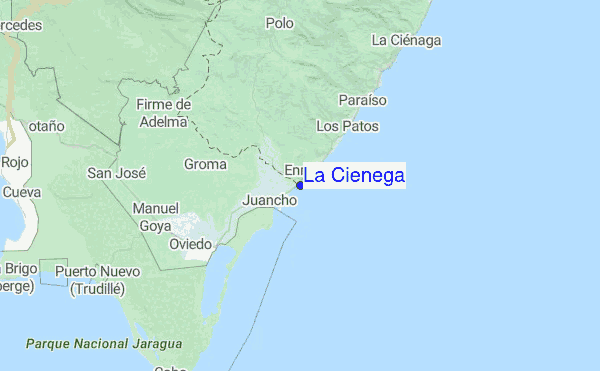
de galerijContourlijnen: Wegen & Rivieren: Kies een surflokatie uit het menu 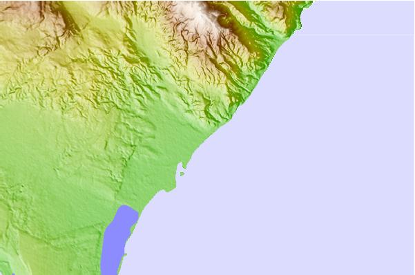
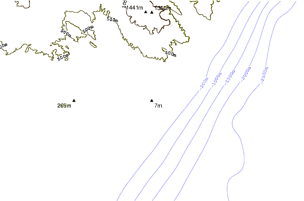
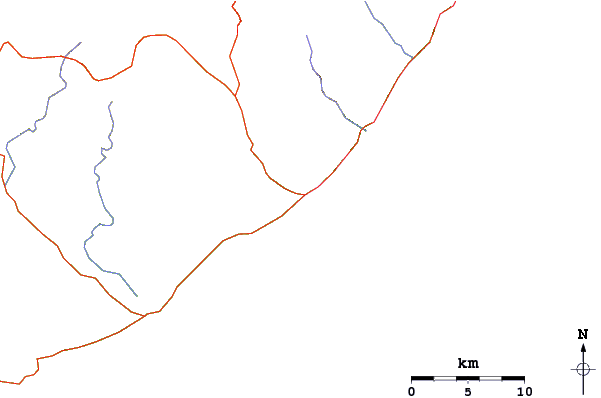
Gebruik deze reliëfkaart om naar de surfspots en de getijdenstations van Caribbean Coast toe te gaan, in de buurt van La Cienega.
Andere Dichtbijzijnde Surflocaties van La Cienega:
(klik op locatienaam voor meer informatie)- Closest Locatie6 mi
- Second closest Locatie7 mi
- Third closest Locatie10 mi
- Fourth closest Locatie18 mi
- Fifth closest Locatie21 mi
Dichtstbijzijnde golfboeien bij La Cienega:
- Closest golfboei263 mi
- Second closest golfboei311 mi
- Third closest golfboei341 mi
- Fourth closest golfboei382 mi
- Fifth closest golfboei415 mi
Getijdenstations in de buurt van La Cienega:
- Closest getijdenstationEnriquillo2 mi
- Second closest getijdenstationParaiso10 mi
- Third closest getijdenstationBarahona25 mi
- Fourth closest getijdenstationPedernales34 mi
- Fifth closest getijdenstationPaya68 mi
Airports
- The closest passenger airport to La Cienega is Maria Montez International (Barahona) Airport (BRX) in Dominican Republic, 43 km (27 miles) away (directly).
- The second nearest airport to La Cienega is Port Au Prince International (Port-au-prince) Airport (PAP) in Haiti, 135 km (84 miles) away.
- Third is Herrera International (Santo Domingo) Airport (HEX) in Dominican Republic, 151 km (94 miles) away.
- Las Americas International (Santo Domingo) Airport (SDQ) in Dominican Republic is 178 km (111 miles) away.
- Cibao International (Santiago) Airport (STI), also in Dominican Republic is the fifth nearest airport to La Cienega and is 183 km (114 miles) away.
- /breaks/La-Cienega/forecasts/latest


 Nearest