

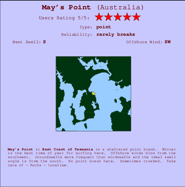
May's Point Surf Guide
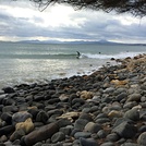
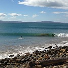
May's Point in East Coast of Tasmania is a sheltered point break. Winter is the favoured time of year for surfing here. Offshore winds blow from the southwest. Groundswells more frequent than windswells and the optimum swell angle is from the south. There is no point break. It's sometimes crowded here. Take care of - Rocks - Localism.
May's Point Spot Info
| Type: | Rating: | Reliability: | Todays Sea Temp*: |
|---|---|---|---|
| rarely breaks | 11.3°C*ocean temperature recorded from satellite |
Surfing May's Point:
The best conditions reported for surf at May's Point occur when a South swell combines with an offshore wind direction from the Southwest.

Voorspelde Golfenergie (Kracht): 12 uur


May's Point Surf:
Wednesday, 15 July 2026, 21:25 Local time| Wed | Thu | |||
| 7PM | 10PM | 1AM | 4AM | |
| Wave (m) | ||||
| Periode (s) | 16 | 16 | 16 | 17 |
| Wind (km/h) | ||||
| Wind | cross- off |
cross- off |
cross- on |
cross |
- /breaks/Mays-Point/forecasts/latest
May's Point Surf Guide
May's Point in East Coast of Tasmania is a sheltered point break. Winter is the favoured time of year for surfing here. Offshore winds blow from the southwest. Groundswells more frequent than windswells and the optimum swell angle is from the south. There is no point break. It's sometimes crowded here. Take care of - Rocks - Localism.
May's Point Spot Info
Type: Rating: Reliability: Todays Sea Temp*:  Point
Point 5
5rarely breaks 11.3°C*ocean temperature recorded from satelliteSurfing May's Point:
The best conditions reported for surf at May's Point occur when a South swell combines with an offshore wind direction from the Southwest.
Voorspelde Golfenergie (Kracht): 12 uur
Gebruik de tabbladen hierboven om de zeewatertemperatuur bij May's Point te bekijken, foto's van May's Point, May's Point gedetailleerde golfvoorspellingen, wind- en weersvoorspellingen, May's Point webcams, actuele wind in TAS - East Coast live weerstations en May's Point getijdenvoorspellingen. De link van Australia golfkaarten opent een grote afbeelding van Australia en de omliggende zeeën. Deze golfkaarten kunnen worden dynamisch gemaakt worden met de verschillende golfcomponenten, golfenergie, golfperiode, golfhoogte, samen met de wind en weersvoorspellingen, het actuele weer en de zeetoestand volgens golfboeien uit Australia, langskomende schepen en weerstations op de kust. Elk voorspelling pagina's voor dit surfstrand zijn voorzien van een wereldwijde en regionale golfzoeker om de beste surfsomstandigheden in het gebied rond May's Point te vinden.
May's Point Surf:
Wednesday, 15 July 2026, 21:25 Local timeWed Thu 7PM 10PM 1AM 4AM Wave (m) Periode (s) 16 16 16 17 Wind (km/h) Wind cross-
offcross-
offcross-
oncross - /breaks/Mays-Point/forecasts/latest
- /breaks/Mays-Point/forecasts/latest/six_day
May's Point Surf Guide
May's Point in East Coast of Tasmania is a sheltered point break. Winter is the favoured time of year for surfing here. Offshore winds blow from the southwest. Groundswells more frequent than windswells and the optimum swell angle is from the south. There is no point break. It's sometimes crowded here. Take care of - Rocks - Localism.
May's Point Spot Info
Type: Rating: Reliability: Todays Sea Temp*: Point5rarely breaks 11.3°C*ocean temperature recorded from satelliteSurfing May's Point:
The best conditions reported for surf at May's Point occur when a South swell combines with an offshore wind direction from the Southwest.
Voorspelde Golfenergie (Kracht): 12 uur
Gebruik de tabbladen hierboven om de zeewatertemperatuur bij May's Point te bekijken, foto's van May's Point, May's Point gedetailleerde golfvoorspellingen, wind- en weersvoorspellingen, May's Point webcams, actuele wind in TAS - East Coast live weerstations en May's Point getijdenvoorspellingen. De link van Australia golfkaarten opent een grote afbeelding van Australia en de omliggende zeeën. Deze golfkaarten kunnen worden dynamisch gemaakt worden met de verschillende golfcomponenten, golfenergie, golfperiode, golfhoogte, samen met de wind en weersvoorspellingen, het actuele weer en de zeetoestand volgens golfboeien uit Australia, langskomende schepen en weerstations op de kust. Elk voorspelling pagina's voor dit surfstrand zijn voorzien van een wereldwijde en regionale golfzoeker om de beste surfsomstandigheden in het gebied rond May's Point te vinden.
May's Point Surf:
Wednesday, 15 July 2026, 21:25 Local timeWed Thu 7PM 10PM 1AM 4AM Wave (m) Periode (s) 16 16 16 17 Wind (km/h) Wind cross-
offcross-
offcross-
oncross - /breaks/Mays-Point/forecasts/latest
May's Point Surf Guide
May's Point in East Coast of Tasmania is a sheltered point break. Winter is the favoured time of year for surfing here. Offshore winds blow from the southwest. Groundswells more frequent than windswells and the optimum swell angle is from the south. There is no point break. It's sometimes crowded here. Take care of - Rocks - Localism.
May's Point Spot Info
Type: Rating: Reliability: Todays Sea Temp*: Point5rarely breaks 11.3°C*ocean temperature recorded from satelliteSurfing May's Point:
The best conditions reported for surf at May's Point occur when a South swell combines with an offshore wind direction from the Southwest.
Voorspelde Golfenergie (Kracht): 12 uur
Gebruik de tabbladen hierboven om de zeewatertemperatuur bij May's Point te bekijken, foto's van May's Point, May's Point gedetailleerde golfvoorspellingen, wind- en weersvoorspellingen, May's Point webcams, actuele wind in TAS - East Coast live weerstations en May's Point getijdenvoorspellingen. De link van Australia golfkaarten opent een grote afbeelding van Australia en de omliggende zeeën. Deze golfkaarten kunnen worden dynamisch gemaakt worden met de verschillende golfcomponenten, golfenergie, golfperiode, golfhoogte, samen met de wind en weersvoorspellingen, het actuele weer en de zeetoestand volgens golfboeien uit Australia, langskomende schepen en weerstations op de kust. Elk voorspelling pagina's voor dit surfstrand zijn voorzien van een wereldwijde en regionale golfzoeker om de beste surfsomstandigheden in het gebied rond May's Point te vinden.
May's Point Surf:
Wednesday, 15 July 2026, 21:25 Local timeWed Thu 7PM 10PM 1AM 4AM Wave (m) Periode (s) 16 16 16 17 Wind (km/h) Wind cross-
offcross-
offcross-
oncross Tide Times:
Voor Clifton Beach, %{dist} %{km} van %{location}.
VOLGENDE IS OM (lokale tijd) resterende tijd hoog water laag water May's Point Tide Times and Tide Chart
Live Weather:
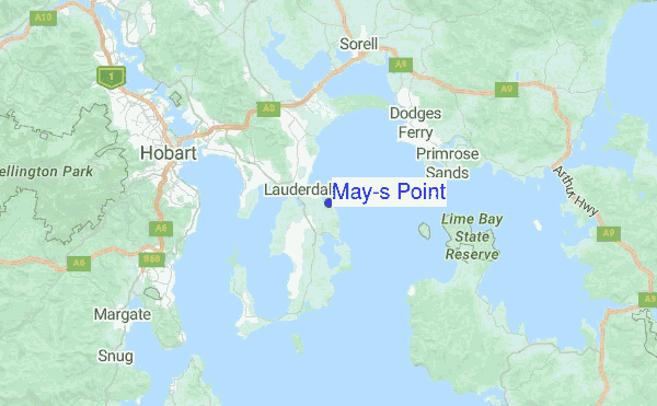
At Mary Ann Bay, 12 km from May's Point.
calm
(km/h)Air temperature
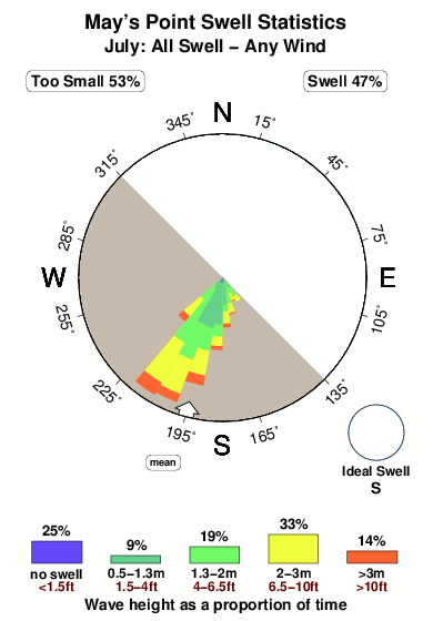
12.3°COverall May's Point Surf Consistency and Wind Distribution in July
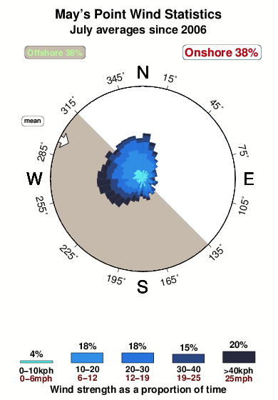


Wind stats for May's Point: see the variation in direction and stength by month.
surffoto's uit
de galerijContourlijnen: Wegen & Rivieren: Kies een surflokatie uit het menu 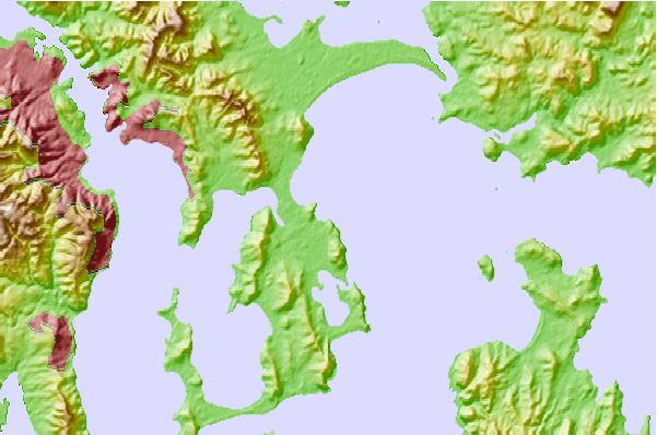
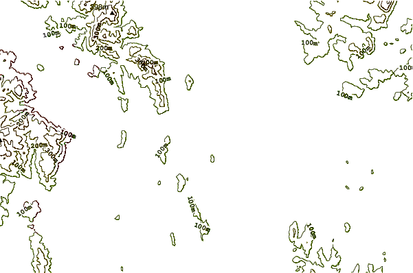
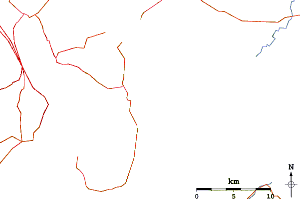
Gebruik deze reliëfkaart om naar de surfspots en de getijdenstations van TAS - East Coast toe te gaan, in de buurt van May's Point.
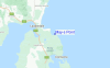
Andere Dichtbijzijnde Surflocaties van May's Point:
(klik op locatienaam voor meer informatie)- Closest Locatie1 mi
- Second closest Locatie2 mi
- Third closest Locatie2 mi
- Fourth closest Locatie4 mi
- Fifth closest Locatie5 mi
Dichtstbijzijnde golfboeien bij May's Point:
- Closest golfboei139 mi
- Second closest golfboei416 mi
- Third closest golfboei521 mi
- Fourth closest golfboei614 mi
- Fifth closest golfboei667 mi
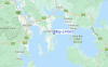
Getijdenstations in de buurt van May's Point:
- Closest getijdenstationHowrah6 mi
- Second closest getijdenstationSandy Bay9 mi
- Third closest getijdenstationHobart10 mi
- Fourth closest getijdenstationKingston11 mi
- Fifth closest getijdenstationLindisfarne11 mi
Airports
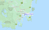
- The nearest passenger airport to May's Point is Hobart Airport (HBA) in Australia, which is 10 km (6 miles) away (directly).
- The second closest airport to May's Point is Launceston Airport (LST), also in Australia, 155 km (96 miles) away.
- /breaks/Mays-Point/forecasts/latest

 Nearest