
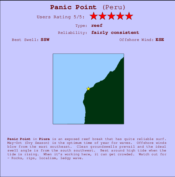
Panic Point Surf Guide
Panic Point in Piura is an exposed reef break that has pretty consitent surf. May-Oct (Dry Season) is the best time of year for waves. Offshore winds blow from the east southeast. Most of the surf here comes from groundswells and the ideal swell direction is from the south southwest. Best around high tide when the tide is rising. Sometimes crowded. Beware of - Rocks, rips, localism, ledgy wave.
Panic Point Spot Info
| Type: | Rating: | Reliability: | Todays Sea Temp*: |
|---|---|---|---|
| fairly consistent | 23.6°C*ocean temperature recorded from satellite |
Surfing Panic Point:
The best conditions reported for surf at Panic Point occur when a South-southwest swell combines with an offshore wind direction from the East-southeast.

Voorspelde Golfenergie (Kracht): 12 uur


Panic Point Surf:
Tuesday, 21 July 2026, 16:45 Local time| Tuesday 21 | Wed | |||
| 4PM | 7PM | 10PM | 1AM | |
| Wave (m) | ||||
| Periode (s) | 12 | 12 | 19 | 12 |
| Wind (km/h) | ||||
| Wind | cross | cross- off |
cross- off |
cross- off |
- /breaks/Panic-Point/forecasts/latest
Panic Point Surf Guide
Panic Point in Piura is an exposed reef break that has pretty consitent surf. May-Oct (Dry Season) is the best time of year for waves. Offshore winds blow from the east southeast. Most of the surf here comes from groundswells and the ideal swell direction is from the south southwest. Best around high tide when the tide is rising. Sometimes crowded. Beware of - Rocks, rips, localism, ledgy wave.
Panic Point Spot Info
Type: Rating: Reliability: Todays Sea Temp*:  Reef
Reef 5
5fairly consistent 23.6°C*ocean temperature recorded from satelliteSurfing Panic Point:
The best conditions reported for surf at Panic Point occur when a South-southwest swell combines with an offshore wind direction from the East-southeast.
Voorspelde Golfenergie (Kracht): 12 uur
Gebruik de tabbladen hierboven om de zeewatertemperatuur bij Panic Point te bekijken, foto's van Panic Point, Panic Point gedetailleerde golfvoorspellingen, wind- en weersvoorspellingen, Panic Point webcams, actuele wind in Piura live weerstations en Panic Point getijdenvoorspellingen. De link van Peru golfkaarten opent een grote afbeelding van Peru en de omliggende zeeën. Deze golfkaarten kunnen worden dynamisch gemaakt worden met de verschillende golfcomponenten, golfenergie, golfperiode, golfhoogte, samen met de wind en weersvoorspellingen, het actuele weer en de zeetoestand volgens golfboeien uit Peru, langskomende schepen en weerstations op de kust. Elk voorspelling pagina's voor dit surfstrand zijn voorzien van een wereldwijde en regionale golfzoeker om de beste surfsomstandigheden in het gebied rond Panic Point te vinden.
Panic Point Surf:
Tuesday, 21 July 2026, 16:45 Local timeTuesday 21 Wed 4PM 7PM 10PM 1AM Wave (m) Periode (s) 12 12 19 12 Wind (km/h) Wind cross cross-
offcross-
offcross-
off- /breaks/Panic-Point/forecasts/latest
- /breaks/Panic-Point/forecasts/latest/six_day
Panic Point Surf Guide
Panic Point in Piura is an exposed reef break that has pretty consitent surf. May-Oct (Dry Season) is the best time of year for waves. Offshore winds blow from the east southeast. Most of the surf here comes from groundswells and the ideal swell direction is from the south southwest. Best around high tide when the tide is rising. Sometimes crowded. Beware of - Rocks, rips, localism, ledgy wave.
Panic Point Spot Info
Type: Rating: Reliability: Todays Sea Temp*: Reef5fairly consistent 23.6°C*ocean temperature recorded from satelliteSurfing Panic Point:
The best conditions reported for surf at Panic Point occur when a South-southwest swell combines with an offshore wind direction from the East-southeast.
Voorspelde Golfenergie (Kracht): 12 uur
Gebruik de tabbladen hierboven om de zeewatertemperatuur bij Panic Point te bekijken, foto's van Panic Point, Panic Point gedetailleerde golfvoorspellingen, wind- en weersvoorspellingen, Panic Point webcams, actuele wind in Piura live weerstations en Panic Point getijdenvoorspellingen. De link van Peru golfkaarten opent een grote afbeelding van Peru en de omliggende zeeën. Deze golfkaarten kunnen worden dynamisch gemaakt worden met de verschillende golfcomponenten, golfenergie, golfperiode, golfhoogte, samen met de wind en weersvoorspellingen, het actuele weer en de zeetoestand volgens golfboeien uit Peru, langskomende schepen en weerstations op de kust. Elk voorspelling pagina's voor dit surfstrand zijn voorzien van een wereldwijde en regionale golfzoeker om de beste surfsomstandigheden in het gebied rond Panic Point te vinden.
Panic Point Surf:
Tuesday, 21 July 2026, 16:45 Local timeTuesday 21 Wed 4PM 7PM 10PM 1AM Wave (m) Periode (s) 12 12 19 12 Wind (km/h) Wind cross cross-
offcross-
offcross-
off- /breaks/Panic-Point/forecasts/latest
Panic Point Surf Guide
Panic Point in Piura is an exposed reef break that has pretty consitent surf. May-Oct (Dry Season) is the best time of year for waves. Offshore winds blow from the east southeast. Most of the surf here comes from groundswells and the ideal swell direction is from the south southwest. Best around high tide when the tide is rising. Sometimes crowded. Beware of - Rocks, rips, localism, ledgy wave.
Panic Point Spot Info
Type: Rating: Reliability: Todays Sea Temp*: Reef5fairly consistent 23.6°C*ocean temperature recorded from satelliteSurfing Panic Point:
The best conditions reported for surf at Panic Point occur when a South-southwest swell combines with an offshore wind direction from the East-southeast.
Voorspelde Golfenergie (Kracht): 12 uur
Gebruik de tabbladen hierboven om de zeewatertemperatuur bij Panic Point te bekijken, foto's van Panic Point, Panic Point gedetailleerde golfvoorspellingen, wind- en weersvoorspellingen, Panic Point webcams, actuele wind in Piura live weerstations en Panic Point getijdenvoorspellingen. De link van Peru golfkaarten opent een grote afbeelding van Peru en de omliggende zeeën. Deze golfkaarten kunnen worden dynamisch gemaakt worden met de verschillende golfcomponenten, golfenergie, golfperiode, golfhoogte, samen met de wind en weersvoorspellingen, het actuele weer en de zeetoestand volgens golfboeien uit Peru, langskomende schepen en weerstations op de kust. Elk voorspelling pagina's voor dit surfstrand zijn voorzien van een wereldwijde en regionale golfzoeker om de beste surfsomstandigheden in het gebied rond Panic Point te vinden.
Panic Point Surf:
Tuesday, 21 July 2026, 16:45 Local timeTuesday 21 Wed 4PM 7PM 10PM 1AM Wave (m) Periode (s) 12 12 19 12 Wind (km/h) Wind cross cross-
offcross-
offcross-
offTide Times:
Voor Cabo Blanco, %{dist} %{km} van %{location}.
VOLGENDE IS OM (lokale tijd) resterende tijd hoog water laag water Panic Point Tide Times and Tide Chart
Live Weather:
At Talara/Cap. FAP Víctor Montes Arias International Airport, 35 km from Panic Point.
moderate winds from the S
(km/h)
Dry and partly cloudyAir temperature
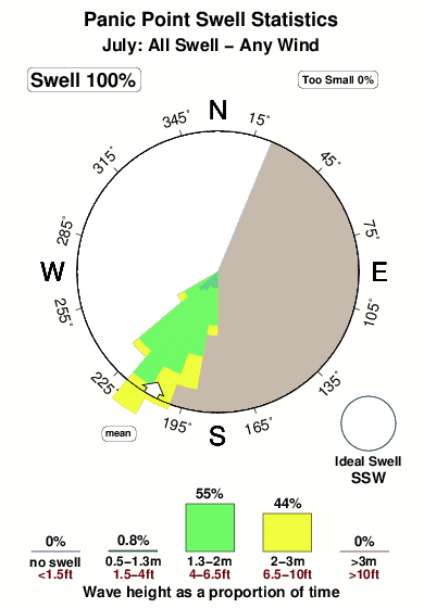
28°COverall Panic Point Surf Consistency and Wind Distribution in July
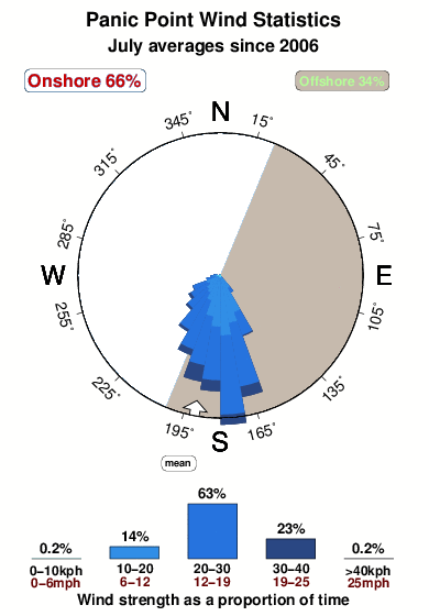


Wind stats for Panic Point: see the variation in direction and stength by month.
surffoto's uit
de galerijContourlijnen: Wegen & Rivieren: Kies een surflokatie uit het menu 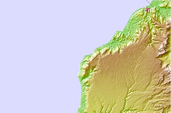
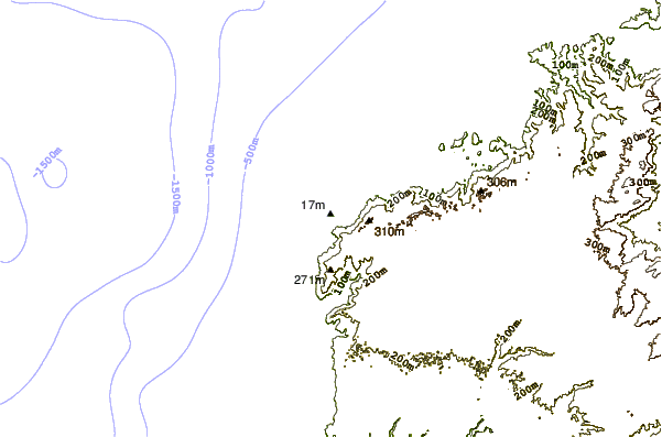
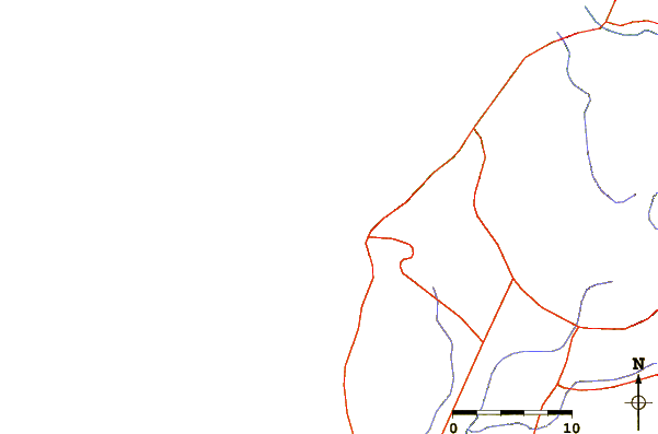
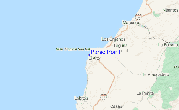
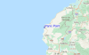
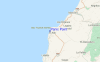
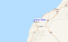
Gebruik deze reliëfkaart om naar de surfspots en de getijdenstations van Piura toe te gaan, in de buurt van Panic Point.
Andere Dichtbijzijnde Surflocaties van Panic Point:
(klik op locatienaam voor meer informatie)- Closest Locatie1 mi
- Second closest Locatie1 mi
- Third closest Locatie2 mi
- Fourth closest Locatie4 mi
- Fifth closest Locatie8 mi
Dichtstbijzijnde golfboeien bij Panic Point:
- Closest golfboei1081 mi
- Second closest golfboei1457 mi
- Third closest golfboei1687 mi
- Fourth closest golfboei1828 mi
- Fifth closest golfboei1831 mi
Getijdenstations in de buurt van Panic Point:
- Closest getijdenstationMancora17 mi
- Second closest getijdenstationTalara23 mi
- Third closest getijdenstationSalinera Colan55 mi
- Fourth closest getijdenstationZorritos57 mi
- Fifth closest getijdenstationPaita58 mi
Airports
- The closest passenger airport to Panic Point is Capitan Montes (Talara) Airport (TYL) in Peru, 36 km (22 miles) away (directly).
- The second nearest airport to Panic Point is Pedro Canga (Tumbes) Airport (TBP), also in Peru, 123 km (76 miles) away.
- Third is Capitan Concha (Piura) Airport (PIU) in Peru, 127 km (79 miles) away.
- General Serrano (Machala) Airport (MCH) in Ecuador is 179 km (111 miles) away.
- General Ulpiano Paez (Salinas) Airport (SNC), also in Ecuador is the fifth nearest airport to Panic Point and is 229 km (142 miles) away.
- /breaks/Panic-Point/forecasts/latest
 Nearest