

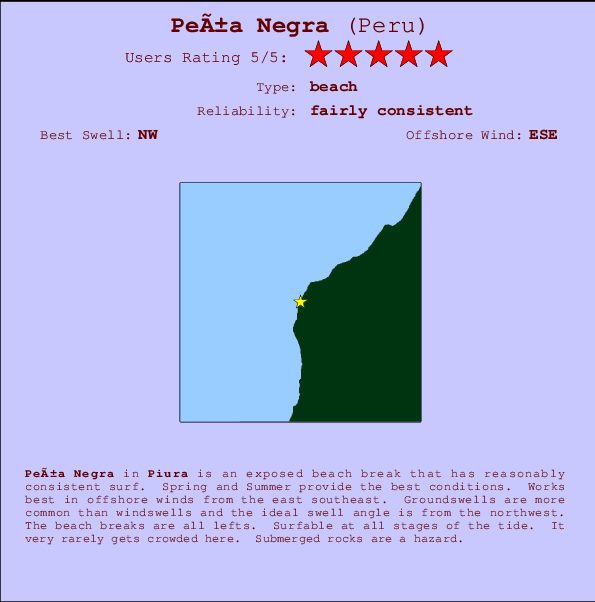
Peña Negra Surf Guide
Peña Negra in Piura is an exposed beach break that has fairly consistent surf. Spring and Summer provide the optimum conditions. Works best in offshore winds from the east southeast. Tends to receive distant groundswells and the ideal swell angle is from the northwest. Prevailing left breaking waves at the beach break. Good surf at all stages of the tide. Unlikely to be too crowded, even when the surf is up. Take care of rocks in the line up.
Peña Negra Spot Info
| Type: | Rating: | Reliability: | Todays Sea Temp*: |
|---|---|---|---|
| fairly consistent | 23.3°C*ocean temperature recorded from satellite |
Surfing Peña Negra:
The best conditions reported for surf at Peña Negra occur when a Northwest swell combines with an offshore wind direction from the East-southeast.

Voorspelde Golfenergie (Kracht): 12 uur


Peña Negra Surf:
Sunday, 12 July 2026, 08:52 Local time| Sunday 12 | ||||
| 10AM | 1PM | 4PM | 7PM | |
| Wave (m) | ||||
| Periode (s) | 13 | 13 | 13 | 13 |
| Wind (km/h) | ||||
| Wind | cross | cross- on |
cross- on |
cross |
- /breaks/Pena-Negra/forecasts/latest
Peña Negra Surf Guide
Peña Negra in Piura is an exposed beach break that has fairly consistent surf. Spring and Summer provide the optimum conditions. Works best in offshore winds from the east southeast. Tends to receive distant groundswells and the ideal swell angle is from the northwest. Prevailing left breaking waves at the beach break. Good surf at all stages of the tide. Unlikely to be too crowded, even when the surf is up. Take care of rocks in the line up.
Peña Negra Spot Info
Type: Rating: Reliability: Todays Sea Temp*:  Beach
Beach 5
5fairly consistent 23.3°C*ocean temperature recorded from satelliteSurfing Peña Negra:
The best conditions reported for surf at Peña Negra occur when a Northwest swell combines with an offshore wind direction from the East-southeast.
Voorspelde Golfenergie (Kracht): 12 uur
Gebruik de tabbladen hierboven om de zeewatertemperatuur bij Peña Negra te bekijken, foto's van Peña Negra, Peña Negra gedetailleerde golfvoorspellingen, wind- en weersvoorspellingen, Peña Negra webcams, actuele wind in Piura live weerstations en Peña Negra getijdenvoorspellingen. De link van Peru golfkaarten opent een grote afbeelding van Peru en de omliggende zeeën. Deze golfkaarten kunnen worden dynamisch gemaakt worden met de verschillende golfcomponenten, golfenergie, golfperiode, golfhoogte, samen met de wind en weersvoorspellingen, het actuele weer en de zeetoestand volgens golfboeien uit Peru, langskomende schepen en weerstations op de kust. Elk voorspelling pagina's voor dit surfstrand zijn voorzien van een wereldwijde en regionale golfzoeker om de beste surfsomstandigheden in het gebied rond Peña Negra te vinden.
Peña Negra Surf:
Sunday, 12 July 2026, 08:52 Local timeSunday 12 10AM 1PM 4PM 7PM Wave (m) Periode (s) 13 13 13 13 Wind (km/h) Wind cross cross-
oncross-
oncross - /breaks/Pena-Negra/forecasts/latest
- /breaks/Pena-Negra/forecasts/latest/six_day
Peña Negra Surf Guide
Peña Negra in Piura is an exposed beach break that has fairly consistent surf. Spring and Summer provide the optimum conditions. Works best in offshore winds from the east southeast. Tends to receive distant groundswells and the ideal swell angle is from the northwest. Prevailing left breaking waves at the beach break. Good surf at all stages of the tide. Unlikely to be too crowded, even when the surf is up. Take care of rocks in the line up.
Peña Negra Spot Info
Type: Rating: Reliability: Todays Sea Temp*: Beach5fairly consistent 23.3°C*ocean temperature recorded from satelliteSurfing Peña Negra:
The best conditions reported for surf at Peña Negra occur when a Northwest swell combines with an offshore wind direction from the East-southeast.
Voorspelde Golfenergie (Kracht): 12 uur
Gebruik de tabbladen hierboven om de zeewatertemperatuur bij Peña Negra te bekijken, foto's van Peña Negra, Peña Negra gedetailleerde golfvoorspellingen, wind- en weersvoorspellingen, Peña Negra webcams, actuele wind in Piura live weerstations en Peña Negra getijdenvoorspellingen. De link van Peru golfkaarten opent een grote afbeelding van Peru en de omliggende zeeën. Deze golfkaarten kunnen worden dynamisch gemaakt worden met de verschillende golfcomponenten, golfenergie, golfperiode, golfhoogte, samen met de wind en weersvoorspellingen, het actuele weer en de zeetoestand volgens golfboeien uit Peru, langskomende schepen en weerstations op de kust. Elk voorspelling pagina's voor dit surfstrand zijn voorzien van een wereldwijde en regionale golfzoeker om de beste surfsomstandigheden in het gebied rond Peña Negra te vinden.
Peña Negra Surf:
Sunday, 12 July 2026, 08:52 Local timeSunday 12 10AM 1PM 4PM 7PM Wave (m) Periode (s) 13 13 13 13 Wind (km/h) Wind cross cross-
oncross-
oncross - /breaks/Pena-Negra/forecasts/latest
Peña Negra Surf Guide
Peña Negra in Piura is an exposed beach break that has fairly consistent surf. Spring and Summer provide the optimum conditions. Works best in offshore winds from the east southeast. Tends to receive distant groundswells and the ideal swell angle is from the northwest. Prevailing left breaking waves at the beach break. Good surf at all stages of the tide. Unlikely to be too crowded, even when the surf is up. Take care of rocks in the line up.
Peña Negra Spot Info
Type: Rating: Reliability: Todays Sea Temp*: Beach5fairly consistent 23.3°C*ocean temperature recorded from satelliteSurfing Peña Negra:
The best conditions reported for surf at Peña Negra occur when a Northwest swell combines with an offshore wind direction from the East-southeast.
Voorspelde Golfenergie (Kracht): 12 uur
Gebruik de tabbladen hierboven om de zeewatertemperatuur bij Peña Negra te bekijken, foto's van Peña Negra, Peña Negra gedetailleerde golfvoorspellingen, wind- en weersvoorspellingen, Peña Negra webcams, actuele wind in Piura live weerstations en Peña Negra getijdenvoorspellingen. De link van Peru golfkaarten opent een grote afbeelding van Peru en de omliggende zeeën. Deze golfkaarten kunnen worden dynamisch gemaakt worden met de verschillende golfcomponenten, golfenergie, golfperiode, golfhoogte, samen met de wind en weersvoorspellingen, het actuele weer en de zeetoestand volgens golfboeien uit Peru, langskomende schepen en weerstations op de kust. Elk voorspelling pagina's voor dit surfstrand zijn voorzien van een wereldwijde en regionale golfzoeker om de beste surfsomstandigheden in het gebied rond Peña Negra te vinden.
Peña Negra Surf:
Sunday, 12 July 2026, 08:52 Local timeSunday 12 10AM 1PM 4PM 7PM Wave (m) Periode (s) 13 13 13 13 Wind (km/h) Wind cross cross-
oncross-
oncross Tide Times:
Voor Cabo Blanco, %{dist} %{km} van %{location}.
VOLGENDE IS OM (lokale tijd) resterende tijd hoog water laag water Peña Negra Tide Times and Tide Chart
Live Weather:
At Talara/Cap. FAP Víctor Montes Arias International Airport, 33 km from Peña Negra.
light winds from the SSE
(km/h)
Dry and partly cloudyAir temperature
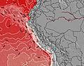
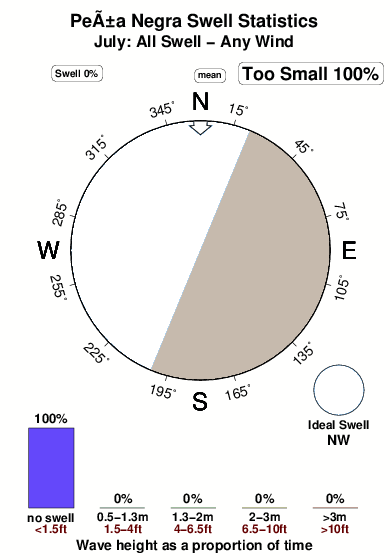
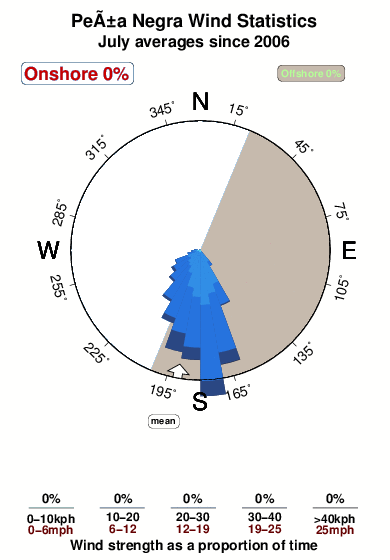
23°COverall Peña Negra Surf Consistency and Wind Distribution in July
surffoto's uit
de galerijContourlijnen: Wegen & Rivieren: Kies een surflokatie uit het menu 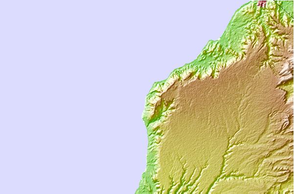
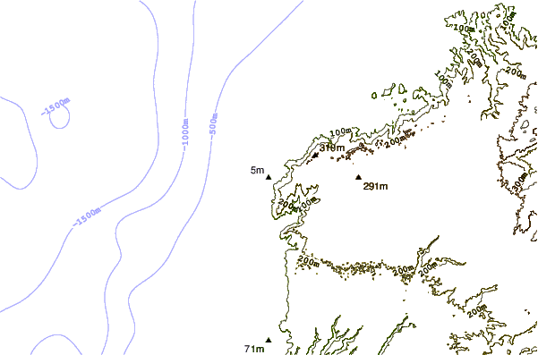
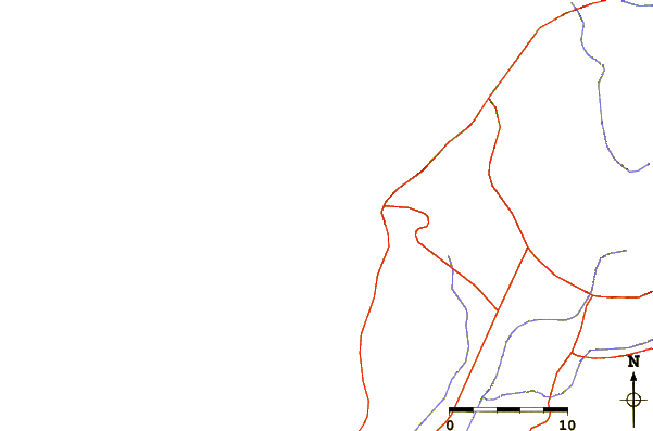
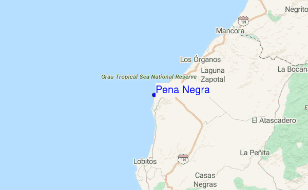
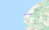
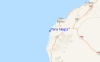
Gebruik deze reliëfkaart om naar de surfspots en de getijdenstations van Piura toe te gaan, in de buurt van Peña Negra.
Andere Dichtbijzijnde Surflocaties van Peña Negra:
(klik op locatienaam voor meer informatie)- Closest Locatie1 mi
- Second closest Locatie2 mi
- Third closest Locatie2 mi
- Fourth closest Locatie6 mi
- Fifth closest Locatie9 mi
Dichtstbijzijnde golfboeien bij Peña Negra:
- Closest golfboei1079 mi
- Second closest golfboei1459 mi
- Third closest golfboei1689 mi
- Fourth closest golfboei1830 mi
- Fifth closest golfboei1833 mi
Getijdenstations in de buurt van Peña Negra:
- Closest getijdenstationMancora18 mi
- Second closest getijdenstationTalara22 mi
- Third closest getijdenstationSalinera Colan54 mi
- Fourth closest getijdenstationPaita57 mi
- Fifth closest getijdenstationZorritos58 mi
Airports
- The closest passenger airport to Peña Negra is Capitan Montes (Talara) Airport (TYL) in Peru, 34 km (21 miles) away (directly).
- The second nearest airport to Peña Negra is Capitan Concha (Piura) Airport (PIU), also in Peru, 125 km (78 miles) away.
- Third is Pedro Canga (Tumbes) Airport (TBP) in Peru, 126 km (78 miles) away.
- General Serrano (Machala) Airport (MCH) in Ecuador is 182 km (113 miles) away.
- General Ulpiano Paez (Salinas) Airport (SNC), also in Ecuador is the fifth nearest airport to Peña Negra and is 232 km (144 miles) away.
- /breaks/Pena-Negra/forecasts/latest


 Nearest