
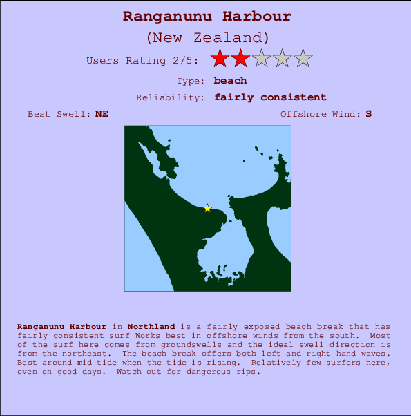
Ranganunu Harbour Surf Guide
Ranganunu Harbour in Northland is a fairly exposed beach break that has fairly consistent surf Works best in offshore winds from the south. Groundswells more frequent than windswells and the ideal swell direction is from the northeast. The beach breaks offer lefts and rights. Best around mid tide when the tide is rising. Unlikely to be too crowded, even when the surf is up. Watch out for dangerous rips.
Ranganunu Harbour Spot Info
| Type: | Rating: | Reliability: | Todays Sea Temp*: |
|---|---|---|---|
| fairly consistent | 16.1°C*ocean temperature recorded from satellite |
Surfing Ranganunu Harbour:
The best conditions reported for surf at Ranganunu Harbour occur when a Northeast swell combines with an offshore wind direction from the South.

Voorspelde Golfenergie (Kracht): 12 uur


Ranganunu Harbour Surf:
Saturday, 18 July 2026, 02:28 Local time| Saturday 18 | ||||
| 3AM | 6AM | 9AM | 12PM | |
| Wave (m) | ||||
| Periode (s) | 16 | 16 | 15 | 15 |
| Wind (km/h) | ||||
| Wind | off | off | off | off |
- /breaks/Ranganunu-Harbour/forecasts/latest
Ranganunu Harbour Surf Guide
Ranganunu Harbour in Northland is a fairly exposed beach break that has fairly consistent surf Works best in offshore winds from the south. Groundswells more frequent than windswells and the ideal swell direction is from the northeast. The beach breaks offer lefts and rights. Best around mid tide when the tide is rising. Unlikely to be too crowded, even when the surf is up. Watch out for dangerous rips.
Ranganunu Harbour Spot Info
Type: Rating: Reliability: Todays Sea Temp*:  Beach
Beach 2
2fairly consistent 16.1°C*ocean temperature recorded from satelliteSurfing Ranganunu Harbour:
The best conditions reported for surf at Ranganunu Harbour occur when a Northeast swell combines with an offshore wind direction from the South.
Voorspelde Golfenergie (Kracht): 12 uur
Gebruik de tabbladen hierboven om de zeewatertemperatuur bij Ranganunu Harbour te bekijken, foto's van Ranganunu Harbour, Ranganunu Harbour gedetailleerde golfvoorspellingen, wind- en weersvoorspellingen, Ranganunu Harbour webcams, actuele wind in Northland live weerstations en Ranganunu Harbour getijdenvoorspellingen. De link van New Zealand golfkaarten opent een grote afbeelding van New Zealand en de omliggende zeeën. Deze golfkaarten kunnen worden dynamisch gemaakt worden met de verschillende golfcomponenten, golfenergie, golfperiode, golfhoogte, samen met de wind en weersvoorspellingen, het actuele weer en de zeetoestand volgens golfboeien uit New Zealand, langskomende schepen en weerstations op de kust. Elk voorspelling pagina's voor dit surfstrand zijn voorzien van een wereldwijde en regionale golfzoeker om de beste surfsomstandigheden in het gebied rond Ranganunu Harbour te vinden.
Ranganunu Harbour Surf:
Saturday, 18 July 2026, 02:28 Local timeSaturday 18 3AM 6AM 9AM 12PM Wave (m) Periode (s) 16 16 15 15 Wind (km/h) Wind off off off off - /breaks/Ranganunu-Harbour/forecasts/latest
- /breaks/Ranganunu-Harbour/forecasts/latest/six_day
Ranganunu Harbour Surf Guide
Ranganunu Harbour in Northland is a fairly exposed beach break that has fairly consistent surf Works best in offshore winds from the south. Groundswells more frequent than windswells and the ideal swell direction is from the northeast. The beach breaks offer lefts and rights. Best around mid tide when the tide is rising. Unlikely to be too crowded, even when the surf is up. Watch out for dangerous rips.
Ranganunu Harbour Spot Info
Type: Rating: Reliability: Todays Sea Temp*: Beach2fairly consistent 16.1°C*ocean temperature recorded from satelliteSurfing Ranganunu Harbour:
The best conditions reported for surf at Ranganunu Harbour occur when a Northeast swell combines with an offshore wind direction from the South.
Voorspelde Golfenergie (Kracht): 12 uur
Gebruik de tabbladen hierboven om de zeewatertemperatuur bij Ranganunu Harbour te bekijken, foto's van Ranganunu Harbour, Ranganunu Harbour gedetailleerde golfvoorspellingen, wind- en weersvoorspellingen, Ranganunu Harbour webcams, actuele wind in Northland live weerstations en Ranganunu Harbour getijdenvoorspellingen. De link van New Zealand golfkaarten opent een grote afbeelding van New Zealand en de omliggende zeeën. Deze golfkaarten kunnen worden dynamisch gemaakt worden met de verschillende golfcomponenten, golfenergie, golfperiode, golfhoogte, samen met de wind en weersvoorspellingen, het actuele weer en de zeetoestand volgens golfboeien uit New Zealand, langskomende schepen en weerstations op de kust. Elk voorspelling pagina's voor dit surfstrand zijn voorzien van een wereldwijde en regionale golfzoeker om de beste surfsomstandigheden in het gebied rond Ranganunu Harbour te vinden.
Ranganunu Harbour Surf:
Saturday, 18 July 2026, 02:28 Local timeSaturday 18 3AM 6AM 9AM 12PM Wave (m) Periode (s) 16 16 15 15 Wind (km/h) Wind off off off off - /breaks/Ranganunu-Harbour/forecasts/latest
Ranganunu Harbour Surf Guide
Ranganunu Harbour in Northland is a fairly exposed beach break that has fairly consistent surf Works best in offshore winds from the south. Groundswells more frequent than windswells and the ideal swell direction is from the northeast. The beach breaks offer lefts and rights. Best around mid tide when the tide is rising. Unlikely to be too crowded, even when the surf is up. Watch out for dangerous rips.
Ranganunu Harbour Spot Info
Type: Rating: Reliability: Todays Sea Temp*: Beach2fairly consistent 16.1°C*ocean temperature recorded from satelliteSurfing Ranganunu Harbour:
The best conditions reported for surf at Ranganunu Harbour occur when a Northeast swell combines with an offshore wind direction from the South.
Voorspelde Golfenergie (Kracht): 12 uur
Gebruik de tabbladen hierboven om de zeewatertemperatuur bij Ranganunu Harbour te bekijken, foto's van Ranganunu Harbour, Ranganunu Harbour gedetailleerde golfvoorspellingen, wind- en weersvoorspellingen, Ranganunu Harbour webcams, actuele wind in Northland live weerstations en Ranganunu Harbour getijdenvoorspellingen. De link van New Zealand golfkaarten opent een grote afbeelding van New Zealand en de omliggende zeeën. Deze golfkaarten kunnen worden dynamisch gemaakt worden met de verschillende golfcomponenten, golfenergie, golfperiode, golfhoogte, samen met de wind en weersvoorspellingen, het actuele weer en de zeetoestand volgens golfboeien uit New Zealand, langskomende schepen en weerstations op de kust. Elk voorspelling pagina's voor dit surfstrand zijn voorzien van een wereldwijde en regionale golfzoeker om de beste surfsomstandigheden in het gebied rond Ranganunu Harbour te vinden.
Ranganunu Harbour Surf:
Saturday, 18 July 2026, 02:28 Local timeSaturday 18 3AM 6AM 9AM 12PM Wave (m) Periode (s) 16 16 15 15 Wind (km/h) Wind off off off off Tide Times:
Voor Sheigis Beacon, New Zealand, %{dist} %{km} van %{location}.
VOLGENDE IS OM (lokale tijd) resterende tijd hoog water laag water Ranganunu Harbour Tide Times and Tide Chart
Live Weather:
At Tokerau Beach wx, 12 km from Ranganunu Harbour.
calm
(km/h)
dryAir temperature
9°COverall Ranganunu Harbour Surf Consistency and Wind Distribution in July


Wind stats for Ranganunu Harbour: see the variation in direction and stength by month.
surffoto's uit
de galerijContourlijnen: Wegen & Rivieren: Kies een surflokatie uit het menu 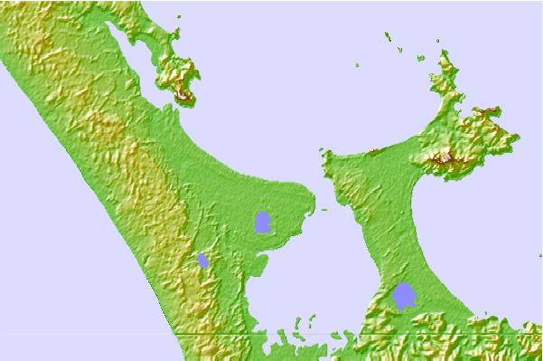
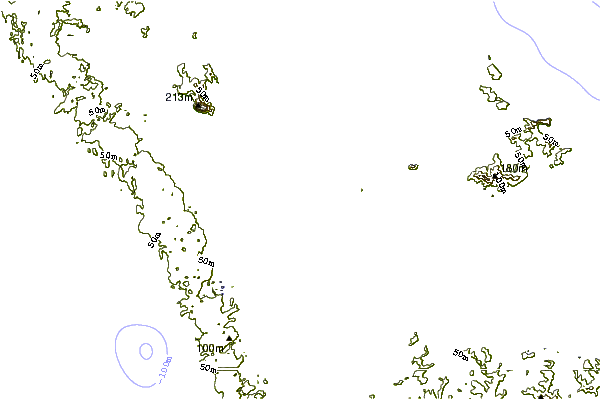
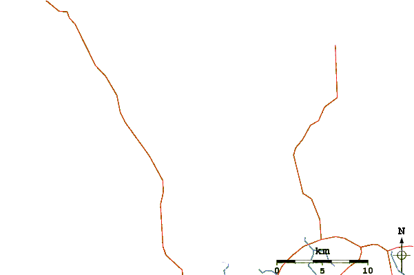
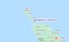
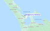
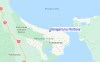
Gebruik deze reliëfkaart om naar de surfspots en de getijdenstations van Northland toe te gaan, in de buurt van Ranganunu Harbour.
Andere Dichtbijzijnde Surflocaties van Ranganunu Harbour:
(klik op locatienaam voor meer informatie)- Closest Locatie3 mi
- Second closest Locatie5 mi
- Third closest Locatie6 mi
- Fourth closest Locatie7 mi
- Fifth closest Locatie9 mi
Dichtstbijzijnde golfboeien bij Ranganunu Harbour:
- Closest golfboei101 mi
- Second closest golfboei270 mi
- Third closest golfboei401 mi
- Fourth closest golfboei441 mi
- Fifth closest golfboei441 mi
Getijdenstations in de buurt van Ranganunu Harbour:
- Closest getijdenstationSheigis Beacon4 mi
- Second closest getijdenstationHouhora River Entrance6 mi
- Third closest getijdenstationHouhora Harbour (Pukenui Wharf)7 mi
- Fourth closest getijdenstationOmaia Island8 mi
- Fifth closest getijdenstationDairy Factory Wharf12 mi
Airports
- The closest passenger airport to Ranganunu Harbour is Kaitaia Airport (KAT) in New Zealand, which is 21 km (13 miles) away (directly).
- The second nearest airport to Ranganunu Harbour is Kerikeri Airport (KKE), also in New Zealand, 74 km (46 miles) away.
- The third closest airport is Whangarei Airport (WRE), also in New Zealand, 142 km (88 miles) away.
- /breaks/Ranganunu-Harbour/forecasts/latest


 Nearest