
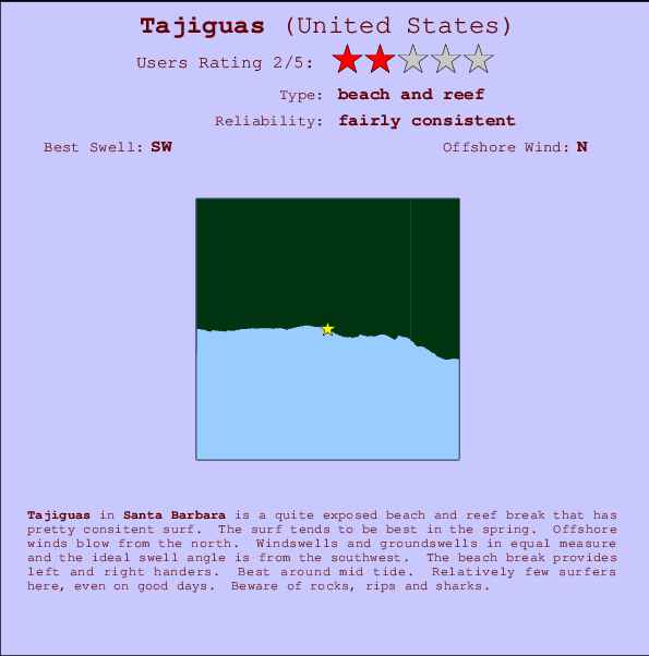
Tajiguas Surf Guide
Tajiguas in Santa Barbara is a quite exposed beach and reef break that has quite reliable surf. The surf tends to be optimum in the spring. Works best in offshore winds from the north. Groundswells and windswells are equally likely and the optimum swell angle is from the southwest. Waves at the beach break both left and right. Best around mid tide. It very rarely gets crowded here. Hazards include rocks, rips and sharks.
Tajiguas Spot Info
| Type: | Rating: | Reliability: | Todays Sea Temp*: |
|---|---|---|---|
| fairly consistent | 19.0°C*ocean temperature recorded from satellite |
Surfing Tajiguas:
The best conditions reported for surf at Tajiguas occur when a Southwest swell combines with an offshore wind direction from the North.

Voorspelde Golfenergie (Kracht): 12 uur


Tajiguas Surf:
Saturday, 18 July 2026, 02:29 Local time| Saturday 18 | ||||
| 2AM | 5AM | 8AM | 11AM | |
| Wave (m) | ||||
| Periode (s) | 17 | 17 | 16 | 18 |
| Wind (km/h) | ||||
| Wind | glass | glass | glass | cross- on |
- /breaks/Tajiguas/forecasts/latest
Tajiguas Surf Guide
Tajiguas in Santa Barbara is a quite exposed beach and reef break that has quite reliable surf. The surf tends to be optimum in the spring. Works best in offshore winds from the north. Groundswells and windswells are equally likely and the optimum swell angle is from the southwest. Waves at the beach break both left and right. Best around mid tide. It very rarely gets crowded here. Hazards include rocks, rips and sharks.
Tajiguas Spot Info
Type: Rating: Reliability: Todays Sea Temp*:  Beach and reef
 2
2fairly consistent 19.0°C*ocean temperature recorded from satelliteSurfing Tajiguas:
The best conditions reported for surf at Tajiguas occur when a Southwest swell combines with an offshore wind direction from the North.
Voorspelde Golfenergie (Kracht): 12 uur
Gebruik de tabbladen hierboven om de zeewatertemperatuur bij Tajiguas te bekijken, foto's van Tajiguas, Tajiguas gedetailleerde golfvoorspellingen, wind- en weersvoorspellingen, Tajiguas webcams, actuele wind in CAL - Santa Barbara live weerstations en Tajiguas getijdenvoorspellingen. De link van United States golfkaarten opent een grote afbeelding van United States en de omliggende zeeën. Deze golfkaarten kunnen worden dynamisch gemaakt worden met de verschillende golfcomponenten, golfenergie, golfperiode, golfhoogte, samen met de wind en weersvoorspellingen, het actuele weer en de zeetoestand volgens golfboeien uit United States, langskomende schepen en weerstations op de kust. Elk voorspelling pagina's voor dit surfstrand zijn voorzien van een wereldwijde en regionale golfzoeker om de beste surfsomstandigheden in het gebied rond Tajiguas te vinden.
Tajiguas Surf:
Saturday, 18 July 2026, 02:29 Local timeSaturday 18 2AM 5AM 8AM 11AM Wave (m) Periode (s) 17 17 16 18 Wind (km/h) Wind glass glass glass cross-
on- /breaks/Tajiguas/forecasts/latest
- /breaks/Tajiguas/forecasts/latest/six_day
Tajiguas Surf Guide
Tajiguas in Santa Barbara is a quite exposed beach and reef break that has quite reliable surf. The surf tends to be optimum in the spring. Works best in offshore winds from the north. Groundswells and windswells are equally likely and the optimum swell angle is from the southwest. Waves at the beach break both left and right. Best around mid tide. It very rarely gets crowded here. Hazards include rocks, rips and sharks.
Tajiguas Spot Info
Type: Rating: Reliability: Todays Sea Temp*: Beach and reef2fairly consistent 19.0°C*ocean temperature recorded from satelliteSurfing Tajiguas:
The best conditions reported for surf at Tajiguas occur when a Southwest swell combines with an offshore wind direction from the North.
Voorspelde Golfenergie (Kracht): 12 uur
Gebruik de tabbladen hierboven om de zeewatertemperatuur bij Tajiguas te bekijken, foto's van Tajiguas, Tajiguas gedetailleerde golfvoorspellingen, wind- en weersvoorspellingen, Tajiguas webcams, actuele wind in CAL - Santa Barbara live weerstations en Tajiguas getijdenvoorspellingen. De link van United States golfkaarten opent een grote afbeelding van United States en de omliggende zeeën. Deze golfkaarten kunnen worden dynamisch gemaakt worden met de verschillende golfcomponenten, golfenergie, golfperiode, golfhoogte, samen met de wind en weersvoorspellingen, het actuele weer en de zeetoestand volgens golfboeien uit United States, langskomende schepen en weerstations op de kust. Elk voorspelling pagina's voor dit surfstrand zijn voorzien van een wereldwijde en regionale golfzoeker om de beste surfsomstandigheden in het gebied rond Tajiguas te vinden.
Tajiguas Surf:
Saturday, 18 July 2026, 02:29 Local timeSaturday 18 2AM 5AM 8AM 11AM Wave (m) Periode (s) 17 17 16 18 Wind (km/h) Wind glass glass glass cross-
on- /breaks/Tajiguas/forecasts/latest
Tajiguas Surf Guide
Tajiguas in Santa Barbara is a quite exposed beach and reef break that has quite reliable surf. The surf tends to be optimum in the spring. Works best in offshore winds from the north. Groundswells and windswells are equally likely and the optimum swell angle is from the southwest. Waves at the beach break both left and right. Best around mid tide. It very rarely gets crowded here. Hazards include rocks, rips and sharks.
Tajiguas Spot Info
Type: Rating: Reliability: Todays Sea Temp*: Beach and reef2fairly consistent 19.0°C*ocean temperature recorded from satelliteSurfing Tajiguas:
The best conditions reported for surf at Tajiguas occur when a Southwest swell combines with an offshore wind direction from the North.
Voorspelde Golfenergie (Kracht): 12 uur
Gebruik de tabbladen hierboven om de zeewatertemperatuur bij Tajiguas te bekijken, foto's van Tajiguas, Tajiguas gedetailleerde golfvoorspellingen, wind- en weersvoorspellingen, Tajiguas webcams, actuele wind in CAL - Santa Barbara live weerstations en Tajiguas getijdenvoorspellingen. De link van United States golfkaarten opent een grote afbeelding van United States en de omliggende zeeën. Deze golfkaarten kunnen worden dynamisch gemaakt worden met de verschillende golfcomponenten, golfenergie, golfperiode, golfhoogte, samen met de wind en weersvoorspellingen, het actuele weer en de zeetoestand volgens golfboeien uit United States, langskomende schepen en weerstations op de kust. Elk voorspelling pagina's voor dit surfstrand zijn voorzien van een wereldwijde en regionale golfzoeker om de beste surfsomstandigheden in het gebied rond Tajiguas te vinden.
Tajiguas Surf:
Saturday, 18 July 2026, 02:29 Local timeSaturday 18 2AM 5AM 8AM 11AM Wave (m) Periode (s) 17 17 16 18 Wind (km/h) Wind glass glass glass cross-
onTide Times:
Voor Beavers, %{dist} %{km} van %{location}.
VOLGENDE IS OM (lokale tijd) resterende tijd hoog water laag water Tajiguas Tide Times and Tide Chart
Live Weather:
At Santa Barbara Airport, 25 km from Tajiguas.
wind obs. (6 kph from 120 degs) was rejected
(km/h)
ClearAir temperature
18.3°CBuoy Data:
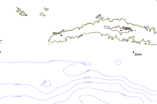
At East Santa Barbara Buoy, 22 miles from Tajiguas.
7PM 8PM 9PM 10PM Gegevens Leeftijd 6 hr 5 hr 4 hr 3 hr Golfhoogte (m) 


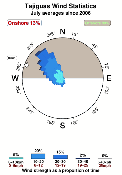
Dominante Periode (s) 6 - 9 8 Overall Tajiguas Surf Consistency and Wind Distribution in July
surffoto's uit
de galerijContourlijnen: Wegen & Rivieren: Kies een surflokatie uit het menu 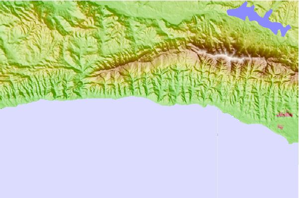
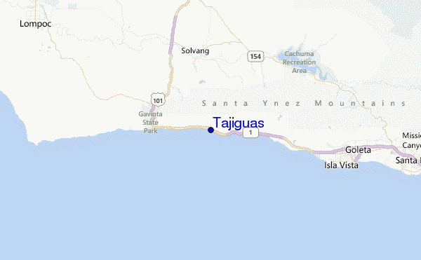
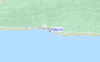
Gebruik deze reliëfkaart om naar de surfspots en de getijdenstations van CAL - Santa Barbara toe te gaan, in de buurt van Tajiguas.
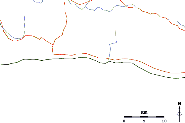
Andere Dichtbijzijnde Surflocaties van Tajiguas:
(klik op locatienaam voor meer informatie)- Closest Locatie1 mi
- Second closest Locatie2 mi
- Third closest Locatie3 mi
- Fourth closest Locatie6 mi
- Fifth closest Locatie7 mi
Dichtstbijzijnde golfboeien bij Tajiguas:
- Closest golfboei22 mi
- Second closest golfboei24 mi
- Third closest golfboei38 mi
- Fourth closest golfboei44 mi
- Fifth closest golfboei50 mi
Getijdenstations in de buurt van Tajiguas:
- Closest getijdenstationGaviota6 mi
- Second closest getijdenstationIsla Vista15 mi
- Third closest getijdenstationGoleta17 mi
- Fourth closest getijdenstationSanta Barbara25 mi
- Fifth closest getijdenstationMontecito27 mi
Airports
- The closest passenger airport to Tajiguas is Vandenberg Afb (Lompoc) Airport (VBG) in USA, 51 km (32 miles) away (directly).
- The second nearest airport to Tajiguas is Point Mugu Nas Airport (NTD), also in USA, 99 km (61 miles) away.
- Third is Meadows Fld (Bakersfield) Airport (BFL) in USA, 144 km (89 miles) away.
- Burbank Glendale Pasadena Airport (BUR) in USA is 164 km (102 miles) away.
- Los Angeles International Airport (LAX), also in USA is the fifth nearest airport to Tajiguas and is 168 km (104 miles) away.
- /breaks/Tajiguas/forecasts/latest


 Nearest