
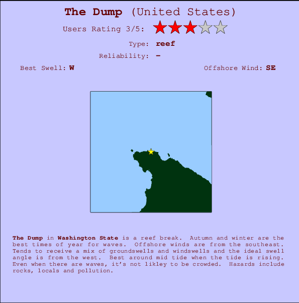
The Dump Surf Guide
The Dump in Washington State is a sheltered reef break. Autumn and winter are the best times of year for waves. The best wind direction is from the southeast. Windswells and groundswells in equal measure and the optimum swell angle is from the west. Best around mid tide when the tide is rising. Unlikely to be too crowded, even when the surf is up. Take care of rocks, locals and pollution.
The Dump Spot Info
| Type: | Rating: | Reliability: | Todays Sea Temp*: |
|---|---|---|---|
11.1°C*ocean temperature recorded from satellite |
Surfing The Dump:
The best conditions reported for surf at The Dump occur when a West swell combines with an offshore wind direction from the Southeast.
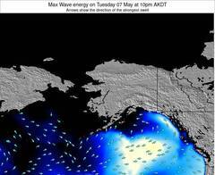
Voorspelde Golfenergie (Kracht): 12 uur
The Dump Surf:
Wednesday, 15 July 2026, 00:53 Local time| Tue | Wed | |||
| 8PM | 11PM | 2AM | 5AM | |
| Wave (m) | ||||
| Periode (s) | 13 | 9 | 10 | 10 |
| Wind (km/h) | ||||
| Wind | cross- on |
glass | cross | cross |
- /breaks/The-Dump/forecasts/latest
The Dump Surf Guide
The Dump in Washington State is a sheltered reef break. Autumn and winter are the best times of year for waves. The best wind direction is from the southeast. Windswells and groundswells in equal measure and the optimum swell angle is from the west. Best around mid tide when the tide is rising. Unlikely to be too crowded, even when the surf is up. Take care of rocks, locals and pollution.
The Dump Spot Info
Type: Rating: Reliability: Todays Sea Temp*:  Reef
Reef 311.1°C*ocean temperature recorded from satellite
Surfing The Dump:
The best conditions reported for surf at The Dump occur when a West swell combines with an offshore wind direction from the Southeast.
Voorspelde Golfenergie (Kracht): 12 uur
Gebruik de tabbladen hierboven om de zeewatertemperatuur bij The Dump te bekijken, foto's van The Dump, The Dump gedetailleerde golfvoorspellingen, wind- en weersvoorspellingen, The Dump webcams, actuele wind in Washington live weerstations en The Dump getijdenvoorspellingen. De link van United States golfkaarten opent een grote afbeelding van United States en de omliggende zeeën. Deze golfkaarten kunnen worden dynamisch gemaakt worden met de verschillende golfcomponenten, golfenergie, golfperiode, golfhoogte, samen met de wind en weersvoorspellingen, het actuele weer en de zeetoestand volgens golfboeien uit United States, langskomende schepen en weerstations op de kust. Elk voorspelling pagina's voor dit surfstrand zijn voorzien van een wereldwijde en regionale golfzoeker om de beste surfsomstandigheden in het gebied rond The Dump te vinden.
The Dump Surf:
Wednesday, 15 July 2026, 00:53 Local timeTue Wed 8PM 11PM 2AM 5AM Wave (m) Periode (s) 13 9 10 10 Wind (km/h) Wind cross-
onglass cross cross - /breaks/The-Dump/forecasts/latest
- /breaks/The-Dump/forecasts/latest/six_day
The Dump Surf Guide
The Dump in Washington State is a sheltered reef break. Autumn and winter are the best times of year for waves. The best wind direction is from the southeast. Windswells and groundswells in equal measure and the optimum swell angle is from the west. Best around mid tide when the tide is rising. Unlikely to be too crowded, even when the surf is up. Take care of rocks, locals and pollution.
The Dump Spot Info
Type: Rating: Reliability: Todays Sea Temp*: Reef311.1°C*ocean temperature recorded from satelliteSurfing The Dump:
The best conditions reported for surf at The Dump occur when a West swell combines with an offshore wind direction from the Southeast.
Voorspelde Golfenergie (Kracht): 12 uur
Gebruik de tabbladen hierboven om de zeewatertemperatuur bij The Dump te bekijken, foto's van The Dump, The Dump gedetailleerde golfvoorspellingen, wind- en weersvoorspellingen, The Dump webcams, actuele wind in Washington live weerstations en The Dump getijdenvoorspellingen. De link van United States golfkaarten opent een grote afbeelding van United States en de omliggende zeeën. Deze golfkaarten kunnen worden dynamisch gemaakt worden met de verschillende golfcomponenten, golfenergie, golfperiode, golfhoogte, samen met de wind en weersvoorspellingen, het actuele weer en de zeetoestand volgens golfboeien uit United States, langskomende schepen en weerstations op de kust. Elk voorspelling pagina's voor dit surfstrand zijn voorzien van een wereldwijde en regionale golfzoeker om de beste surfsomstandigheden in het gebied rond The Dump te vinden.
The Dump Surf:
Wednesday, 15 July 2026, 00:53 Local timeTue Wed 8PM 11PM 2AM 5AM Wave (m) Periode (s) 13 9 10 10 Wind (km/h) Wind cross-
onglass cross cross - /breaks/The-Dump/forecasts/latest
The Dump Surf Guide
The Dump in Washington State is a sheltered reef break. Autumn and winter are the best times of year for waves. The best wind direction is from the southeast. Windswells and groundswells in equal measure and the optimum swell angle is from the west. Best around mid tide when the tide is rising. Unlikely to be too crowded, even when the surf is up. Take care of rocks, locals and pollution.
The Dump Spot Info
Type: Rating: Reliability: Todays Sea Temp*: Reef311.1°C*ocean temperature recorded from satelliteSurfing The Dump:
The best conditions reported for surf at The Dump occur when a West swell combines with an offshore wind direction from the Southeast.
Voorspelde Golfenergie (Kracht): 12 uur
Gebruik de tabbladen hierboven om de zeewatertemperatuur bij The Dump te bekijken, foto's van The Dump, The Dump gedetailleerde golfvoorspellingen, wind- en weersvoorspellingen, The Dump webcams, actuele wind in Washington live weerstations en The Dump getijdenvoorspellingen. De link van United States golfkaarten opent een grote afbeelding van United States en de omliggende zeeën. Deze golfkaarten kunnen worden dynamisch gemaakt worden met de verschillende golfcomponenten, golfenergie, golfperiode, golfhoogte, samen met de wind en weersvoorspellingen, het actuele weer en de zeetoestand volgens golfboeien uit United States, langskomende schepen en weerstations op de kust. Elk voorspelling pagina's voor dit surfstrand zijn voorzien van een wereldwijde en regionale golfzoeker om de beste surfsomstandigheden in het gebied rond The Dump te vinden.
The Dump Surf:
Wednesday, 15 July 2026, 00:53 Local timeTue Wed 8PM 11PM 2AM 5AM Wave (m) Periode (s) 13 9 10 10 Wind (km/h) Wind cross-
onglass cross cross Tide Times:
Voor Neah Bay, Washington, %{dist} %{km} van %{location}.
VOLGENDE IS OM (lokale tijd) resterende tijd hoog water laag water The Dump Tide Times and Tide Chart
Live Weather:
At BUOY-NEAW1, 5 km from The Dump.
- Air temperature
-°CBuoy Data:
At Neah Bay Buoy, 7 miles from The Dump.
7PM 8PM 9PM 10PM Gegevens Leeftijd 4 hr 3 hr 2 hr 1 hr Golfhoogte (m) 


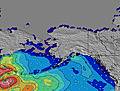
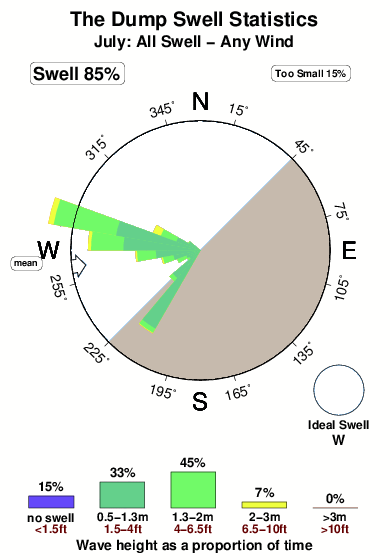
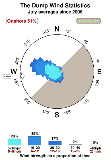
Dominante Periode (s) 9 9 14 14 Overall The Dump Surf Consistency and Wind Distribution in July
surffoto's uit
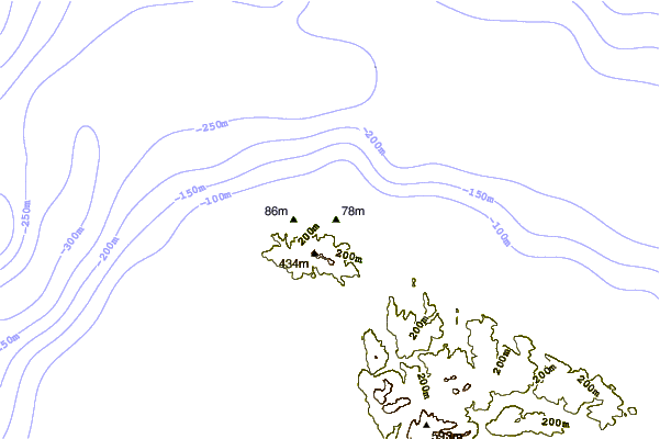
de galerijContourlijnen: Wegen & Rivieren: Kies een surflokatie uit het menu 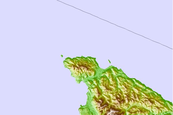
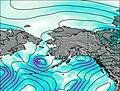
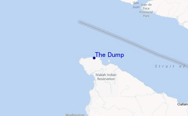
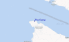
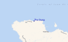
Gebruik deze reliëfkaart om naar de surfspots en de getijdenstations van Washington toe te gaan, in de buurt van The Dump.
Andere Dichtbijzijnde Surflocaties van The Dump:
(klik op locatienaam voor meer informatie)- Closest Locatie2 mi
- Second closest Locatie5 mi
- Third closest Locatie10 mi
- Fourth closest Locatie14 mi
- Fifth closest Locatie21 mi
Dichtstbijzijnde golfboeien bij The Dump:
- Closest golfboei7 mi
- Second closest golfboei68 mi
- Third closest golfboei69 mi
- Fourth closest golfboei72 mi
- Fifth closest golfboei78 mi
Getijdenstations in de buurt van The Dump:
- Closest getijdenstationNeah Bay2 mi
- Second closest getijdenstationTatoosh Island, Cape Flattery, Strait of Juan de Fuca3 mi
- Third closest getijdenstationMakah Bay6 mi
- Fourth closest getijdenstationCape Alava16 mi
- Fifth closest getijdenstationPort Renfrew16 mi
Airports
- The closest passenger airport to The Dump is Nanaimo Airport (YCD) in Canada, 94 km (58 miles) away (directly).
- The second nearest airport to The Dump is Victoria International Airport (YYJ), also in Canada, 96 km (60 miles) away.
- Third is Port Angeles Cgas Airport (NOW) in USA, 97 km (60 miles) away.
- Tofino Airport (YAZ) in Canada is 112 km (70 miles) away.
- Vancouver International Airport (YVR), also in Canada is the fifth nearest airport to The Dump and is 141 km (88 miles) away.
- /breaks/The-Dump/forecasts/latest


 Nearest