
Golfvoorspellingen:

Voorspelling Lange TermijnMeestal droog. Warm (max 27°C op woensdagmiddag, min 16°C op vrijdagavond). Wind zal licht zijn over het algemeen. | Dagen 5-7 WeerssamenvattingMeestal droog. Warm (max 24°C op dinsdagochtend, min 15°C op zaterdagavond). Wind zal licht zijn over het algemeen. | ||||||||||||||||||||
Wed 15 | Thursday 16 | Friday 17 | Saturday 18 | Sunday 19 | Monday 20 | Tuesday 21 | |||||||||||||||
mid- dag | nacht | och- tend | mid- dag | nacht | och- tend | mid- dag | nacht | och- tend | mid- dag | nacht | och- tend | mid- dag | nacht | och- tend | mid- dag | nacht | och- tend | mid- dag | nacht | och- tend | |
Golfhoogte kaart |  |  |  |  |  |  |  | 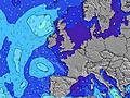 | |||||||||||||
Golf Hoogte (m) Richting Periode (s) | W 9 | W 9 | W 8 | W 9 | NNW 5 | NNW 5 | NW 5 | NNW 4 | NNW 4 | NNW 4 | NNW 5 | NNW 5 | NNW 5 | NNW 5 | W 9 | NNW 5 | NNW 5 | NNW 5 | W 10 | NNW 5 | W 9 |
Golf Grafiek | |||||||||||||||||||||
14 | 15 | 6 | 14 | 14 | 17 | 10 | 18 | 13 | 18 | 46 | 28 | 9 | 8 | 6 | 14 | 34 | 19 | 17 | 19 | 15 | |
Wind (km/h) | |||||||||||||||||||||
Wind onshore cross-onshore cross-shore cross-offshore offshore glasachtig | off | glassy | cross-off | cross | glassy | cross-on | cross-on | cross | cross | cross | cross-off | off | cross | cross-off | cross | cross | cross-off | cross-off | cross | cross-off | cross-on |
Vloed | 7:14PM7.46m | 7:40AM7.18m | 8:01PM7.55m | 8:25AM7.13m | 8:46PM7.44m | 9:09AM6.93m | 9:29PM7.16m | 9:52AM6.61m | 10:13PM6.74m | 10:36AM6.23m | 10:58PM6.25m | 11:22AM5.81m | 11:46PM5.75m | 12:14PM5.43m | |||||||
Eb | 1:36AM0.10m | 1:53PM0.21m | 2:22AM0.09m | 2:37PM0.26m | 3:06AM0.24m | 3:21PM0.47m | 3:49AM0.55m | 4:03PM0.80m | 4:32AM0.96m | 4:47PM1.22m | 5:16AM1.41m | 5:34PM1.66m | 6:04AM1.85m | ||||||||
— | — | 5:24 | — | — | 5:24 | — | — | 5:26 | — | — | 5:26 | — | — | 5:28 | — | — | 5:30 | — | — | 5:31 | |
— | 9:25 | — | — | 9:24 | — | — | 9:23 | — | — | 9:22 | — | — | 9:22 | — | — | 9:21 | — | — | 9:19 | 9:17 | |
mm | — | — | — | — | — | — | — | — | — | — | — | — | — | — | — | — | — | — | — | — | — |
Temp. °C | 27 | 23 | 25 | 24 | 20 | 22 | 22 | 19 | 19 | 19 | 16 | 23 | 23 | 20 | 18 | 17 | 17 | 24 | 23 | 21 | 22 |
Chill °C | 26 | 23 | 21 | 22 | 20 | 20 | 21 | 18 | 16 | 15 | 12 | 17 | 17 | 16 | 14 | 13 | 14 | 21 | 18 | 20 | 21 |
Swell 1 Hoogte (m) Richting Periode (s) | W 9 | N 4 | W 8 | N 4 | NNW 5 | NNW 5 | W 8 | W 8 | W 8 | W 8 | W 8 | NNW 5 | NNW 5 | NNW 5 | W 9 | W 11 | WNW 11 | NNW 5 | W 10 | NNW 5 | W 9 |
14 | 2 | 6 | 4 | 14 | 17 | 5 | 5 | 5 | 5 | 5 | 28 | 9 | 8 | 6 | 10 | 23 | 19 | 17 | 19 | 15 | |
Swell 2 Hoogte (m) Richting Periode (s) | W 16 | W 9 | NNW 4 | W 9 | W 9 | W 8 | W 13 | W 13 | — | W 14 | — | W 7 | W 7 | W 9 | W 12 | W 8 | W 8 | W 10 | W 16 | W 10 | — |
5 | 15 | 2 | 14 | 6 | 5 | 3 | 3 | — | 4 | — | 4 | 4 | 2 | 3 | 1 | 1 | 18 | 5 | 16 | — | |
Swell 3 Hoogte (m) Richting Periode (s) | W 13 | W 16 | W 10 | SW 7 | SW 6 | W 13 | S 6 | — | — | — | — | — | NE 4 | W 7 | — | W 8 | W 18 | — | — | W 16 | — |
3 | 5 | 2 | 2 | 2 | 3 | 1 | — | — | — | — | — | 1 | 1 | — | 1 | 6 | — | — | 5 | — | |
Windgolven Hoogte (m) Richting Periode (s) | NNE 4 | — | — | — | — | — | NW 5 | NNW 4 | NNW 4 | NNW 4 | NNW 5 | — | — | — | NNW 4 | NNW 5 | NNW 5 | — | NNW 4 | — | NW 4 |
7 | — | — | — | — | — | 10 | 18 | 13 | 18 | 46 | — | — | — | 6 | 14 | 34 | — | 14 | — | 4 | |
Dichtstbijzijnd Glasachtig of Offshore | |||||||||||||||||||||
Afstand (km) | 90 | 240 | 232 | 60 | 291 | 291 | 1190 | 405 | 409 | 535 | 264 | 39 | 90 | 397 | 396 | 396 | 21 | 14 | 39 | 22 | 90 |
Beste voorspelde golfomstandigheden in North Cornwall | |||||||||||||||||||||
Beste voorspelde golfomstandigheden in United Kingdom | |||||||||||||||||||||
Wereldwijde Golfzoeker | |||||||||||||||||||||
- Map Icons:
 Break
Break Live Wave Height (m)
 Live Wind Speed (km/h)
 Surf Rating (10 Max)
 Ocean Swells (m)
- Wind Speed (km/h)
GRATIS Surf-Forecast.com widget voor je website
Het gratis surfbericht/weer widget hieronder is beschikbaar voor websites en geeft een samenvatting van de golfvoorspelling voor Trebarwith Strand. Kopieer de HTML-code en plak deze in je eigen site. Je kunt je eigen voorkeurstaal en eenheden kiezen zodat de voorspelling afgesteld is op de gebruikers van jouw site. Klik hier voor de code.
Informatie over de golfvoorspellingen voor Trebarwith Strand
De bovenstaande golfvoorspellingstabel voor Trebarwith Strand biedt essentiële informatie om te bepalen of de surfomstandigheden goed zullen zijn in de komende 16 dagen. Een algemene gids voor het surfen bij Trebarwith Strand kan worden gevonden door het selecteren van de lokale surfgids optie in het grijze menu. Onze Trebarwith Strand golfvoorspelling is uniek omdat deze de golfenergie (power) toont die het werkelijke gevoel van de branding definieert, in plaats van alleen de hoogte of de periode. Surf je regelmatig op dezelfde plek (Trebarwith Strand), neem notitie van de golfenergie uit de golfvoorspelling tabel iedere keer dat je gaat. Al snel kun je je eigen surfdagen kiezen op basis van de golfenergie alleen of in combinatie met onze voorspellingen voor offshore wind. Onze sterwaardering zal daarbij helpen en uiteraard vindt je ook de gebruikelijke golfhoogte en de periode in onze golfvoorspelling, evenals meer details over de golfcomponent, onder de optie ervaren gebruiker (klik op de kleine Einstein onder de getijdentabel om deze optie te zien).
Nadere informatie voor veelgestelde vragen over onze surfprognose voor Trebarwith Strand kan gevonden worden onder het tabblad 'Help' op de menu hierboven, maar ook door met de muis over de vraagtekens op de golfvoorspellingstabel zelf te gaan. Let steeds op dat de voorspelling geschikt is voor open water dicht bij de kust en dat lokale factoren op elke surfstrand invloed hebben op de uiteindelijke brekende golfhoogte, zoals het strand/rif profiel, waterdieptes ver van het strand en beschutting.
Are you planning a holiday in North Cornwall? If you are looking for accommodation near Trebarwith Strand, camping, hotels and holiday cottages in North Cornwall, consider staying in Padstow which is 16 km (10 miles) away. Other places in and around North Cornwall where you can find information about places to rent, and car hire include Bodmin which is 19 km (12 miles) away, Bude, Par and Saint Austell.
 Nearest